
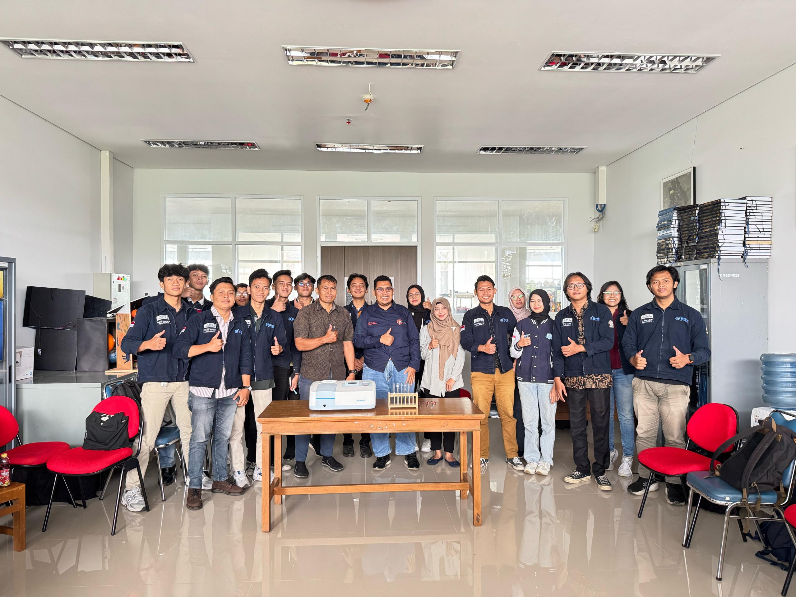
The Undergraduate Program in Geodetic Engineering, Faculty of Engineering, Diponegoro University remains committed to preparing students to face challenges in the professional world through curriculum strengthening and practical skill development. One such effort was realized through the Spectrophotometer BK-UV1200 Workshop, held on Monday, April 28, 2025, at the Photogrammetry and Remote Sensing Laboratory.
This workshop was led directly by Nurhadi Bashit, S.T., M.Eng., as the Coordinator of the Photogrammetry and Remote Sensing Laboratory for the 2025 period. The activity was attended by all laboratory assistants and final-year students conducting research in the field of remote sensing. In his remarks, Mr. Nurhadi emphasized the importance of technical understanding of advanced tools in remote sensing. The training aimed to enhance students’ ability to understand and operate the spectrophotometer, particularly in the context of remote sensing data analysis. A spectrophotometer is used to identify the characteristics of an object based on its interaction with ultraviolet and visible light, whether through absorption or transmission. This technology enables users to verify and compare measurement data with previous information, such as satellite imagery or other numerical data, to produce valid and accurate conclusions.
As a follow-up, the Undergraduate Program in Geodetic Engineering plans to integrate the use of spectrophotometers into practical courses and research in remote sensing and environmental studies. This initiative is part of a curriculum development strategy to make learning more contextual, adaptive, and aligned with current advancements in geospatial technology. Through this training, it is expected that students will not only grasp the theoretical concepts of remote sensing but also master the technical skills required to operate relevant instruments, thereby enhancing the quality of research and professional competence in the geospatial and environmental sectors.
Quoting Albert Einstein, “The important thing is not to stop questioning. Curiosity has its own reason for existing,” the Department of Geodetic Engineering, Faculty of Engineering, Diponegoro University encourages all academic members to continue learning and adapting to the latest technologies in remote sensing, in order to contribute meaningfully to scientific advancement and public welfare.

